Producers Association of San Isidro Cusibamba - Settlement of Yanahuara, Communities of Huacahuasi, Lares Ayllu, Patacancha and Huilloc
The creation of the Mantanay Conservation Area responds to the initiative of the Producers Association San Isidro Cusibamba and the settlement of Yanahuara, which, being benefited by the environmental services, decided to protect the water basin whose waters descend from the highest snow-capped mountains of Mantanay.
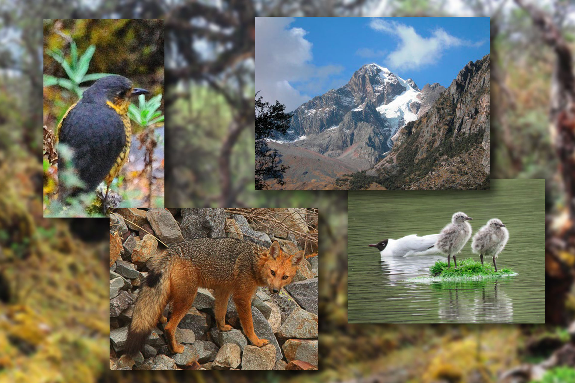
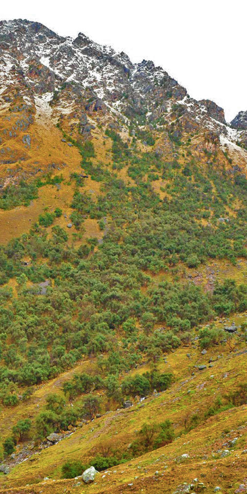
The ecological significance of the Conservation Area is found in its forests of Polylepis or queuñas, which fulfill the role of climate regulator, controller of surface run-off, and the last refuge and habitat of endangered bird species.
Mantanay is a part of the Vilcanota Mountain Range and the Sacred Valley of the Incas, having archaeological remains, such as the Inca Rakay, Inca channels that show this place was once occupied by the Quechuas.
The micro-basin of Mantanay is supplied by lagoons, such as Yuraccocha and Aurorayccocha, which are fed by other adjacent lagoons. In the place there is a native forest of Polylepis, and a section of the QhapaqÑan. On its way, it goes through the Saqsaqllave pass that connects with the community of Huacahuasi and the valley of Lares.
Geographic Characteristics
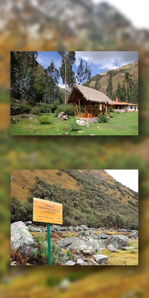
The Mantanay Conservation Area is located in the settlement of Yanahuara, Cusco Region, Province and District of Urubamba, between 3,650 and 4,950 m.a.s.l.
Tourist Aspects
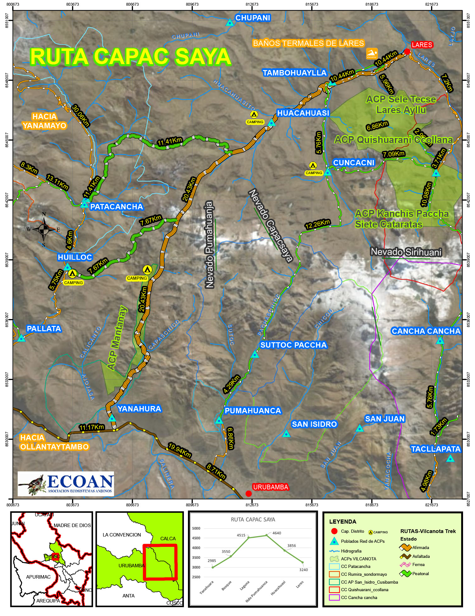
The tourist circuit within the Mantanay conservation area has main connections that are the communities of Huacahuasi, Lares, Patacancha and Huilloc. There are alternate routes to appreciate the Polylepis forests of Mantanay, lagoons and some archaeological remains. The tourist roads are:
The Route Capaqsaya
It includes the route of Yanahuara - Mantanay - Huacahuasi - Lares.
The route within the conservation area is mountain and nature. Everything begins in the town of Yanahuara at 2,863 m.a.s.l. Among the attractions are the Polylepis forests (queuñas), the endemic avifauna with its main representative the Royal Cinclodes. In the sector of Mantanay there are camping spaces. On the way up, you find lagoons, such as Yuraccocha and Aurorayccocha, of remarkable scenery beauty, until reaching the Saqsaqllave pass at 4,500 m.a.s.l. Then you begin to descend until reaching the community of Huacahuasi at 3,650 m.a.s.l., where you can get food and lodging in rural homes. After a comfortable descent of 1 to 2 hours, you will arrive at the thermal waters of Lares, and finally will finish in the town of Lares at 3,200 m.a.s.l. The route is also traveled in reverse, starting from Lares and ending in Mantanay.
Connection with the route of Yanacocha
It includes the route of Lares Ayllu, Huacahuasi, Lagoon Yanaccocha and Patacancha.
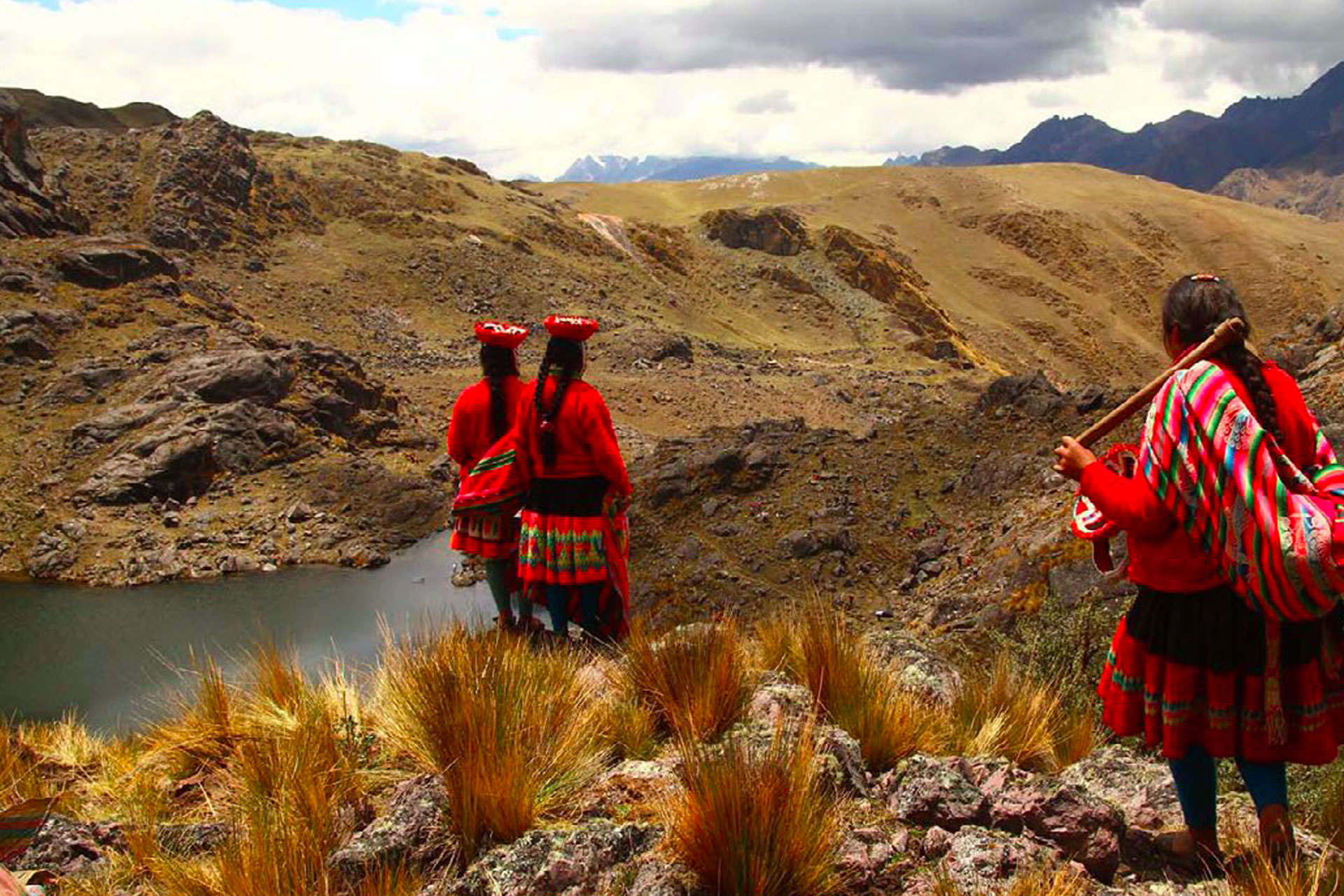
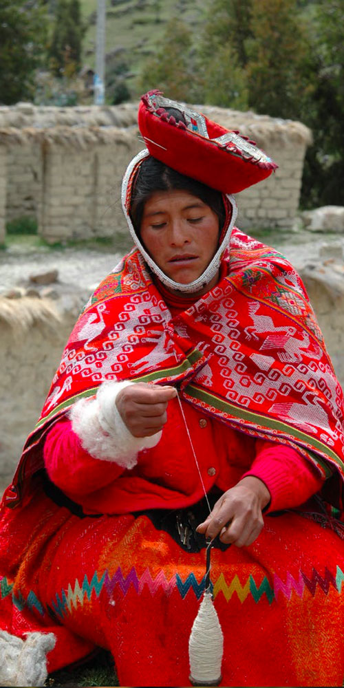
The first day, you leave early Ollantaytambo towards the Peasant Community of Patacancha, arriving at 9:00 am approximately. After appreciating the textile handicrafts with iconography proper of the area, the trekking continues up through the ravine of the community of Patacancha to observe the nature and birds until arriving in 4 hours at the native forest of Quenañas de Yanaccocha and the same lagoon. Here you have lunch to continue ascending through the high Andean landscapes, observe the South American camelids, and reach the Huayruruyoc pass and its beautiful square-shaped Auroruyoc lagoon, and a smaller one called Romano ccocha. The trekking continues until you reach -in 2 hours- the Saqsaqllave pass. From here you begin to descend for 2 hours approximately to the sector of Naranpata where you will camp.
The second day, you continue descending to observe high Andean landscapes until reaching the community of Huacahuasi, where you can appreciate the textile handicrafts. The downhill road continues until you reach the thermal baths of Lares in order to take a relaxing bath, and then continue to Cusco. The route can also start in Lares - Huacahuasi – Patacancha, where there is a camping area implemented in the sector of Huamanripayoc.
Connection to the Route of Queuñacocha
From Ollantaytambo you continue towards the community of Huilloc with vehicular transportation. In Huilloc, you start the trek through the pass of Queuñaccocha river to arrive in 3 to 4 hours to the forest of Polylepis of Queuñaccocha at of 4,100 m.a.s.l., where there is an implemented camping area. After lunch, you continue uphill going through the HuayruruyocKasa pass at 4,300 m.a.s.l, then you go through the main pass of Saqsaqllave at 4,500 m.a.s.l., and in two hours of walking you reach the Naranpata sector, where we can camp or continue to the community of Huacahuasi, in order to carry out living tourism and camping. In the Huacahuasi community, you will find textile handicrafts. Two more hours down you will reach the thermal baths of Lares. From here you go to Cusco or the trek to Huacahuasi begins, so that the next day you continue to the community of Huilloc.